

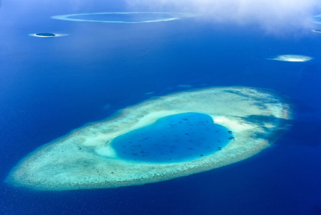
Most coral reefs we know today have been fished, polluted, built around or cooked by marine heatwaves. So when scientists want to know what a healthy reef is supposed to look like, they have very few places left to check. Two of the best are tiny rings of sand and coral in the middle of the Pacific called Bikar and Bokak.
A new study published on November 11 in Frontiers in Marine Science gives the most complete picture yet of these two uninhabited atolls in the northern Marshall Islands. The team didn’t just look at the shallow reef. They surveyed everything from the forests and seabird colonies on land to deep reefs about 275 meters below the surface. UNILAD Tech called them two “untouched worlds,” and the data backs that up.
The short version
- Bikar and Bokak sit more than 850 km north of Majuro, the Marshall Islands’ capital, and nobody lives on either one.
- Sharks are the biggest single group of reef fish by weight, making up about a third of the fish biomass at Bokak.
- Divers, baited cameras and a crewed submersible recorded several species never logged in the area before, plus a few that may be new to science.
- 15 of 17 seabird species seen on land were confirmed or likely breeding.
- The waters around both atolls are now the Marshall Islands’ first national marine sanctuary, covering 48,136 square kilometers.
Where Bikar and Bokak are
The Marshall Islands is a nation of 29 coral atolls and 5 islands spread across almost 2 million square kilometers of the central Pacific, roughly between Hawaii and the Philippines. Bikar and Bokak (Bokak is also known as Taongi) are at the far northern end of the Ratak, or “Sunrise,” chain. They’re several hundred kilometers from any inhabited island, which is the whole reason they’ve stayed in such good shape.
They aren’t completely free of people, though. The community of Utirik Atoll, home to just 264 people at the 2021 census, has looked after them for generations. Utirik residents visit seasonally to harvest seabirds, turtles and eggs under strict traditional rules. Lead author Dr. Alan Friedlander of National Geographic Pristine Seas called the atolls a “gift” from that community.
How you survey a reef from the sky to the deep sea
The fieldwork happened in 2023, as a joint expedition between the Marshall Islands Marine Resources Authority and National Geographic Pristine Seas, building on earlier surveys from 2019. What makes this study stand out is how many different tools it combined.
The survey stack, from land to the deep
ON LAND
Walking surveys of vegetation, seabird colonies and turtle nesting beaches.
10 TO 20 M
SCUBA divers count fish and corals along 50 meter transects.
OPEN WATER
Baited cameras (BRUVS) on the seabed and hanging at 10 m to film sharks and big predators.
DOWN TO 275 M
The DeepSee submersible, a crewed sub rated to 450 m, films the twilight zone reefs.
THE DEEP SEA
Drop cameras in pressure-proof glass spheres, baited with mackerel, record deep-sea life.
The baited camera systems, known as BRUVS (baited remote underwater video systems), are a clever bit of low-tech science. You put about a kilogram of crushed oily fish in a canister in front of a camera and wait. Anything hungry nearby comes to investigate, so you can count sharks and other shy predators without a diver scaring them off.
The DeepSee sub is the high-tech end. It’s a one-atmosphere submersible, which means the people inside stay at normal surface pressure, sitting in a clear acrylic sphere. That let the team see reefs between roughly 30 and 150 meters, the so-called mesophotic or “twilight” zone, which is too deep for regular diving and is still one of the least explored habitats on the planet.
A reef where sharks rule
The headline finding is how much big fish there is, especially sharks. Scientists usually measure reef health by fish biomass, the total weight of fish in a given area, measured in grams per square meter. A heavily fished reef might hold just a few dozen grams per square meter. Bokak’s outer reef held several hundred.
Reef fish biomass on the outer reef (grams per square meter)
Source: Friedlander et al., Frontiers in Marine Science, 2026. Mean values from diver surveys.
Bokak, shallow (10 m): 445 g/m²
Bokak, deep (20 m): 378 g/m²
Bikar, deep (20 m): 218 g/m²
Bikar, shallow (10 m): 210 g/m²
Sharks were the largest single group by weight on both atolls, at 26.8% of reef fish biomass at Bikar and 33.9% at Bokak. Grey reef sharks showed up on nearly every baited camera drop at both sites, with blacktip and whitetip reef sharks also common. Open-water cameras recorded 15 kinds of fish from 8 families, including sharks, jacks and wahoo.
That “inverted pyramid,” where predators make up a huge share of the fish, is a classic sign of a reef that hasn’t been fished hard. A famous 2008 study of the remote Line Islands found the same thing. Untouched Kingman Reef had far more fish, and far more sharks, than nearby Kiritimati, where people fish. Once you remove the predators, you rarely see that structure again.
2.4x
more shark biomass at Bokak than Bikar
275 m
deepest reef habitat surveyed by sub
15 / 17
seabird species breeding
132
turtle nest pits on Bikar
Twin atolls that turned out very different
You’d expect two atolls in the same remote corner of the ocean to look alike. They don’t. The study found that each one is healthy in its own way, which is a useful reminder that there’s no single template for a “pristine” reef.
| Feature | Bikar | Bokak |
|---|---|---|
| Reef fish biomass | Lower, about 46% of Bokak’s | Higher at every depth |
| Seafloor | Around 20% hard coral, lots of seaweed on deep, windward slopes | Coral dominated, with corals and encrusting algae covering 60 to 80% |
| Sea turtles | Almost all nesting: 71 crawls and 132 nest pits, mostly green turtles | Very little nesting |
| On land | Larger Pisonia forest, more Polynesian rats | Fewer rats, smaller forest |
| Deep corals | Less extensive deep coral | Hard corals reaching about 100 to 120 m |
Bikar’s extra seaweed doesn’t automatically mean it’s in worse shape. Natural factors like wave exposure, the atoll’s shape and how water flows through the lagoon all shape what grows where. That’s exactly why having two very different but both healthy reference sites is so valuable.
New records from the twilight zone
The deeper the team went, the less anyone knew. The sub and deep cameras turned up multiple species never recorded in the northern Marshall Islands, along with a few animals the researchers could only identify provisionally. Some of those may turn out to be species new to science once experts take a closer look. UNILAD Tech, summarizing the findings, noted that 14 of the groups observed were recorded in the Marshall Islands for the first time.
Why “first record” matters
A new regional record doesn’t always mean a brand new species. It often means an animal known from somewhere else has been confirmed in a new place for the first time. That still matters, because it shows how little of the deep reef has actually been looked at, even inside a single country’s waters.
Why a remote reef matters to everyone else
Scientists call places like Bikar and Bokak reference systems. If you’re trying to restore a damaged reef in Florida, Hawaii or the Philippines, you need to know what “healthy” actually looks like. Without that baseline, every generation of researchers tends to accept a more degraded reef as normal. Friedlander put it simply: the atolls are “among the best ecological reference systems we have to better understand what we have lost elsewhere.”
The timing matters too. Ocean heat is pushing reefs harder every year, and forecasts for the coming El Niño are grim. We covered why scientists warn this super El Niño could be one of the deadliest on record, and coral bleaching is one of its most visible side effects. Remote reefs aren’t immune to heat, but reefs with healthy fish populations, especially plenty of plant-eating fish that keep seaweed in check, tend to recover better after bleaching.
A sanctuary the size of two US states
Following the research, the Marshall Islands declared the waters around both atolls its first national marine sanctuary. At 48,136 square kilometers, it’s roughly the size of Vermont and New Hampshire combined. It’s part of the country’s Reimaanlok framework, a community-based conservation plan that aims to protect half of the nation’s coastal marine resources by 2030.
The researchers want monitoring to cover the whole system, not just shallow reefs, so they can spot climate-driven changes from the treetops to the deep sea. As Friedlander said, “Bikar and Bokak are not just treasures for the Marshall Islands but for the entire planet.” For two specks of sand most people will never see, that’s a big job.
About this article: GeekBlog covers U.S. technology news, AI, phones, smartwatches and gaming. Every story is written and checked under our Editorial Policy. Spotted a mistake or have a story tip? Contact our editors.
