

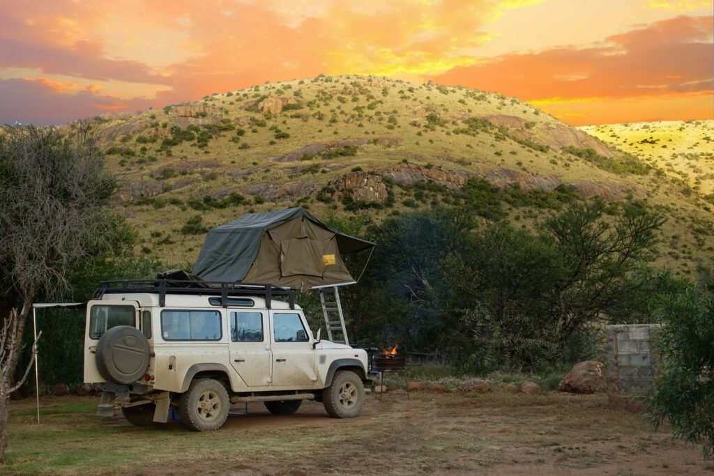
Todd Benney and Henry Harrison had been driving across Africa for about six weeks when their 1994 Land Rover Defender started to sink. They were out on Botswana’s Makgadikgadi Salt Pans, one of the biggest salt flat systems on Earth, with no phone signal. Their plan to walk out went wrong as night fell and they started seeing animal tracks. What got them back to the car, and probably saved their lives, was a free app and three words Harrison had saved earlier that day.
The story is now going around because the pair, both recent UK graduates, credit what3words for their survival. It is a great story. It is also a useful reminder of what your phone can and cannot do when you are far from a cell tower.
The short version
- Todd Benney, 24, and Henry Harrison, 23, got their Land Rover stuck on Botswana’s Makgadikgadi Salt Pans during a trip across Africa in 2025.
- Walking toward help, they turned back at dusk after spotting animal tracks. A location saved in what3words, plus its offline compass, led them back to the car in the dark.
- They eventually walked about 70 km over 14 hours across two days, ran out of water, and reached a guarded gate where police, the army and an ambulance were called.
- The key point: phone GPS works without signal. What failed them was the map, not the satellites.
- None of the major phone satellite SOS services currently cover Botswana. A dedicated satellite messenger does.
What happened on the salt pans
The two friends, Benney from Newbury and Harrison from Jersey, set off on their drive across Africa in September 2025. About six weeks in, they began a crossing of the Makgadikgadi Pans. According to their account in UK coverage of the story, the engine began struggling about 15 km in, and the car finally sank roughly 35 km into the flats.
With no signal, they decided to walk toward the nearest village. As it started getting dark, they realized they were not getting closer. “It got to like 6:30pm and started getting dark, and we weren’t getting any closer,” Benney said. “That’s when we noticed animal tracks towards the bush area.” Their options were to walk through the bush in the dark or go back to the car.
They chose the car. The problem was finding it. A screenshot of Google Maps was not much help on a flat white surface with no landmarks. Then Harrison remembered he had saved the Land Rover’s position in what3words.
“It gave us a direction to walk in,” Harrison said. “We found out we were further from the car than we thought. Then we saw the moon catch one of the wing mirrors; it was a great moment.”
Sleeping in the car instead of in the open was the turning point. They refilled on water and set out again. The full walk took about 14 hours over two days and covered roughly 70 km. Harrison did part of it in Birkenstocks and got heatstroke. “By the end, we were just dripping water drops into our mouths; it was boiling and there was no shade,” he said.
They finally reached a security gate with two guards. “I was so emotional I was fighting back tears,” Benney said. Police, an ambulance and soldiers arrived within minutes. The pair say a police commander told them a couple had gone missing in the area a year earlier and were never found. We could not find an independent record of that case, so treat it as their recollection. The Land Rover was pulled out several days later, and the two finished their trip, eventually selling the car in Tanzania.
Why the Makgadikgadi Pans are so dangerous
The pans are the dried bed of an ancient lake that was once larger than Switzerland. Today they cover about 16,000 square kilometers, which is around 6,200 square miles. The two main pans, Sua and Ntwetwe, are each roughly 100 km across.
The danger is what sits under the surface. A hard crust of salt can hide soft, sticky clay that local drivers call “cotton clay.” When it is damp, a heavy vehicle can break through and sink, and recovery vehicles sent to help can get stuck too. Rain falls roughly from November to March, when parts of the pans flood. Drivers who know the area say you should never cross alone, and never after rain.
How what3words actually helped
what3words divides the world into about 57 trillion squares, each 3 meters by 3 meters, and gives every square a unique three word address. The app works offline: it calculates your address from your phone’s GPS position, so you do not need signal or data. It also has a compass mode that points you toward a saved address.
That last feature did the heavy lifting here. But it is worth being precise about why it worked. The magic was not the three words. It was two simple things:
- They saved the car’s location before they left it. Without a saved point, no app can guide you back.
- The phone’s GPS kept working with zero signal. GPS receivers listen to satellites. They do not need a cell network at all.
Plenty of other free apps can do the same job if you prepare in advance, including dropping a pin in an offline map. If you are heading somewhere remote with your phone as your main tool, our guides to the best GPS smartwatches cover devices that can track and backtrack a route without a phone at all.
Your offline location options, compared
Here is how the common tools stack up if you lose signal. The column that matters most is the last one: none of the phone based satellite SOS services currently list Botswana as a supported country.
| Tool | Cost | Works without signal? | Can it call for help? | Works in Botswana? |
|---|---|---|---|---|
| Phone GPS + offline map | Free | Yes, if maps are downloaded first | No | Yes |
| what3words | Free app | Yes | No, it gives you a location to share | Yes |
| Google Plus Codes | Free, open standard | Yes | No | Yes |
| iPhone Emergency SOS via satellite | Free for now | Yes, with a clear view of the sky | Yes | No, not a supported country |
| Pixel or Galaxy satellite SOS | Free for now on supported models | Yes | Yes | No, limited to listed countries |
| Garmin inReach | About $300 to $400 device, plus a plan from about $8 a month | Yes, global Iridium network | Yes, two way SOS | Yes |
Apple’s service has been free since the iPhone 14 launched it in 2022, and the company has extended the free period again and again, as we covered in our piece on Apple’s four years of free satellite access. It covers about 20 countries, mostly in North America, Europe and the Pacific. Southern Africa is not on the list yet. Prices for Garmin plans vary by region, so check before you travel.
If you are driving somewhere remote
Benney and Harrison got lucky, and they know it. Most of what saved them came down to a few habits anyone can copy:
- Save your vehicle’s location every time you leave it, in any app you trust.
- Stay with the car when possible. It gives you shade and is far easier for rescuers to spot than a person on foot. The Phoenix Fire Department gives the same advice for desert breakdowns.
- Tell someone your route and when you expect to arrive, so a search starts if you do not.
- Carry far more water than you think, at least three gallons per person for desert travel, plus recovery straps and a shovel.
- Carry a real satellite device where phone SOS is not available. A personal locator beacon or inReach can call for help from anywhere.
- Download offline maps and pack a power bank, because GPS and screen use drain batteries fast.
“You guys saved our lives, literally,” Benney said, thanking what3words. “Without what3words, we were about to sleep out on the open salt pan and most likely not have survived the night.” The more general lesson is that a phone with GPS is a powerful survival tool, as long as you have prepared it before you lose signal.
Sources and further reading
- UNILAD Tech: Two friends credit a phone app with saving their lives after their Land Rover sank in the desert
- Yahoo News: Graduates walk 70km through Botswana bush
- Wikipedia: Makgadikgadi Pan
- NASA Earth Observatory: Makgadikgadi Salt Pans
- what3words: About
- Rudy Arthur, University of Exeter: study of what3words address confusion
- TechCrunch: what3words sends legal threat to a security researcher
- MacRumors: Apple extends free satellite access
- Google: Pixel Satellite SOS availability
- Garmin: inReach subscription plans
- Wikipedia: Open Location Code (Plus Codes)
About this article: GeekBlog covers U.S. technology news, AI, phones, smartwatches and gaming. Every story is written and checked under our Editorial Policy. Spotted a mistake or have a story tip? Contact our editors.
